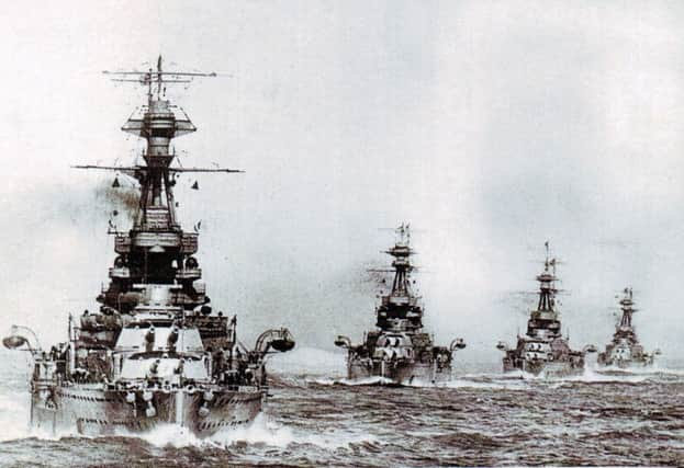
Charting the course of Royal Navy's biggest battle


And now an interactive map is helping to share the stories of the thousands of sailors who took part in the Battle of Jutland, when the Royal Navy faced down the might of Kaiser Wilhelm’s German fleet.
‘Many of the people who went out there didn’t come back,’ says Casey Keppel-Compton from the National Museum of the Royal Navy (NMRN), who is digital manager of the project.
Advertisement
Hide AdAdvertisement
Hide Ad‘We can’t allow them to be forgotten – they mustn’t be the forgotten sailors.’
Visitors to the map, which is online at nautoguide.com, can zoom in on entries to read more about the sailors, ships, memorials and sites connected with the First World War battle which took place from May 31 to June 1, 1916.
People can also contribute their own stories of ancestors who were involved in the battle.
Ms Keppel-Compton said the response to the project had been ‘mindblowing’.
Advertisement
Hide AdAdvertisement
Hide AdShe said: ‘On one evening after it was launched we had 10,000 unique users from around the world – it was 100 hits a second.
‘Since then we’ve had a constant stream of emails sent to us from people telling fantastic stories about their Jutland family members.
‘A lot of those stories would have previously been hidden in loft boxes.’
Ms Keppel-Compton said a key feature was the ability to share stories found on the map through social media.
Advertisement
Hide AdAdvertisement
Hide AdShe said the project was being driven by a team of 15 volunteers who were working from home inputting information, and the ‘back-end’ developers at Wiltshire-based tech firm NautoGuide.
Ms Keppel-Compton said: ‘We also hope to one day be able to tell the German side of the story. We have a relationship with the German Naval Museum so there is the possibility that will eventually happen.’
Among those who have taken a keen interest in the map is Nick Jellicoe, grandson of Admiral Sir John Jellicoe, who commanded the British Grand Fleet in the battle.
Mr Jellicoe said: ‘This is one of those moments where engaging with the interactive map and what the museum is providing is a real opportunity to fill in some parts of a jigsaw, a family jigsaw you’ve never been able to solve. It’s nice to think about stories from your father, grand-father or great-grandfather, and be able to pass them on.
Advertisement
Hide AdAdvertisement
Hide Ad‘Always one of my biggest regrets is that I never talked to my father in more detail about his father.
‘I never did, and I hope other people don’t make the same mistake.’
The Battle of Jutland is often considered to be a turning point of the war, and although far more British than German lives were lost – 6,094 compared to 2,551 – it is usually thought of as a British victory.
At the end of the battle the British maintained numerical supremacy – only two dreadnoughts were damaged, leaving 23 dreadnoughts and four battlecruisers still able to fight, whilst the Germans had only 10 dreadnoughts.
Advertisement
Hide AdAdvertisement
Hide AdThere have already been more than 6,000 entries included on the map, with many assembled in collaboration with Trevor Penfold at the Imperial War Museum, volunteers from Portsmouth Grammar School, and Karen O’Rawe. Portsdown U3A has also incorporated data from a research project it has been doing about the impact the battle had on people in Portsmouth and Gosport.
A major exhibition about the Battle of Jutland is due to open at the NMRN on May 12.
36 Hours: Jutland 1916, The Battle That Won The War is described as a ‘once-in-a-lifetime’ opportunity to bring together material from across the UK and Germany to mark the centenary of the battle.
Head of heritage development Nick Hewitt said: ‘The Battle of Jutland is the Royal Navy’s defining moment in the Great War, and perhaps the largest sea battle in history.
Advertisement
Hide AdAdvertisement
Hide Ad‘It’s the only event in the UK’s national First World War centenary programme which is wholly naval in character, and at the NMRN we’ve pulled out all the stops to put together a comprehensive and exciting programme of activity to mark it.’