
Glasgow Cycle Paths: New images show how four major Glasgow roads will look once new cycle paths are installed
Images of how key roads could look when the first of Glasgow’s 270 kilometres cycle paths are laid down have been released for people to comment on.
Concept visualisations can be seen for Maryhill Road, Royston Road, Pollokshaws Road and Langside Avenue among others as part of a consultation running until 20 October.
The new cycle routes will run through streets in the inner north and south neighbourhoods.
The city network phase 1 plan in the areas will form about 56 kilometres of active travel routes.


The consultation survey is currently running until Sunday, October 20 asking residents for feedback on “emerging design proposals” for the inner north and south city network.
Drop in events were held in September and people can still visit local libraries to take a look at potential designs and visualisations.

The council said: “The success of the City Network is reliant on input from local people to help the team understand key issues in each neighbourhood, with this local knowledge informing the developing designs.”
It added: “The City Network will comprise around 270 km of routes across the city, providing accessible, safe, direct and comfortable journeys for Glasgow’s citizens.”
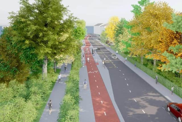
The paths aim to enable everyone to travel by foot or bike including those aged over 80 as well as be usable all year and eliminate traffic danger as a reason not to cycle.
To complete the survey visit: https://www.smartsurvey.co.uk/s/ATSInnerNorthAndSouth
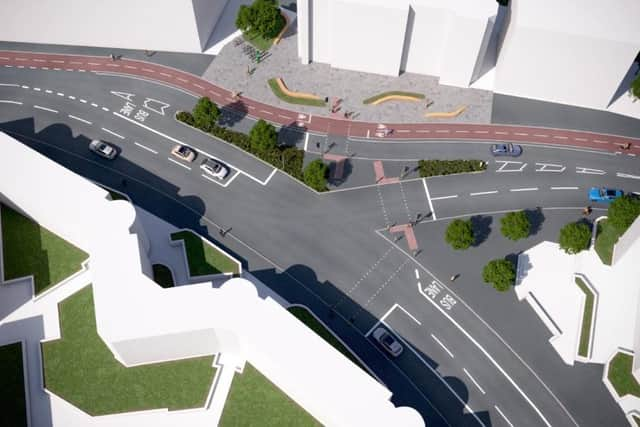
Routes will run in the following roads:
Inner North Routes:
- Route 1 – Maryhill Road
- Route 4 – Hawthorn Street
- Route 7 – Broomfield Road
- Route 9 – Cumbernauld Road
- Route 10 – Royston Road
- Route 11 – Viewpark AvenueRoute 12 – Royston RoadRoute 13 – Carlisle Street
- Route 15 – Possil Road
- Route 16 – Atlas Road
- Route 17 – Pinkston Road
- Route 18 – Provan Road
- Route 19 – Campsie Street
South Routes
- Route 6A – Kilmarnock Road
- Route 6B – Darnley Road/St Andrews Road
- Route 6C – Langside Avenue
- Route 7 – Devon Street/West Street
- Route 9 – Titwood Road
- Route 10 – Haggs Road/Pollokshaws Road
- Route 11 – Newlands Road/Riverford RoadRoute 12 – Clarkston Road/Holmlea Road
- Route 14 – Sinclair Drive/Kintore Road
- Route 15 – Somerville Drive
- Route 16 – Dixon Avenue
- Route 17 – Minard Road
- Route 18 – Dinmount Road
- Route 19 – Merrylee Road
- Route 20 – Shawmoss Road