
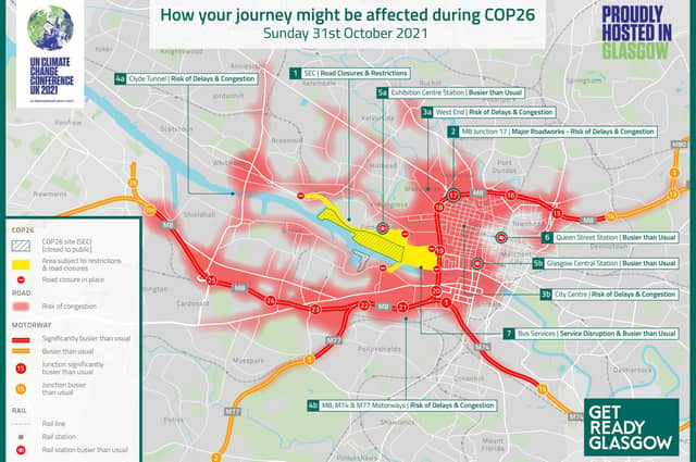
While the discussions and decisions made at COP26 might have a huge impact on the world, the event itself will have a huge impact on the roads around the city.
The climate summit is being held at the Scottish Events Campus. Roads around the venue – including the Clydeside Expressway – will be closed during the summit. It has also been reported that parts of the M8 could be shut during the event as VIPs, including US President Joe Biden and the Queen, will be travelling to the city from Edinburgh.
With road closures in place and thousands more people driving in Glasgow, congestion will be a major issue. Thankfully, getreadyglasgow.com, a hub of information from Glasgow City Council and partners, has provided detailed maps showing where congestion could be worst during COP26.
Here are the roads and routes to avoid during the summit.
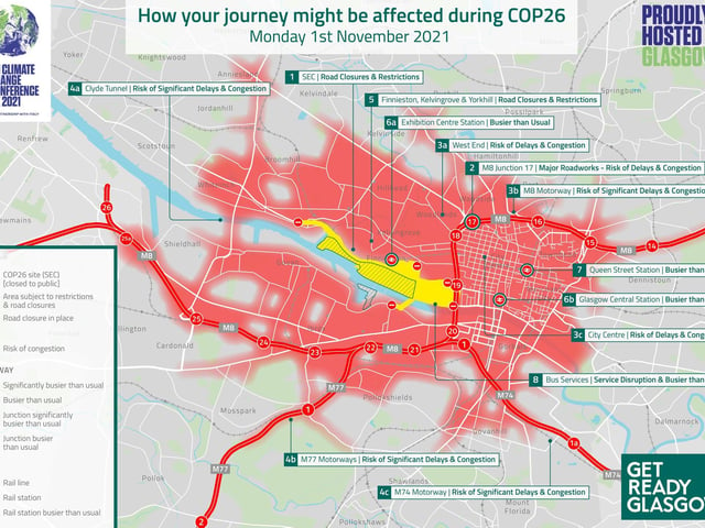
1. COP26 traffic
How roads could be affected on the first day of COP26. Photo: getreadyglasgow.com
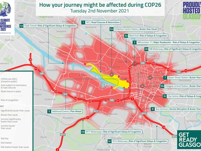
2. COP26 traffic
The state of Glasgow roads on November 2. Photo: getreadyglasgow.com
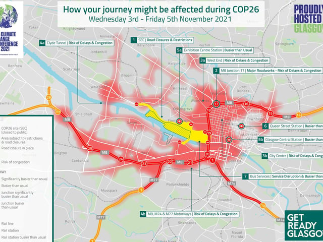
3. COP26 traffic
How Glasgow roads will be affected between November 3-5. Photo: getreadyglasgow.com
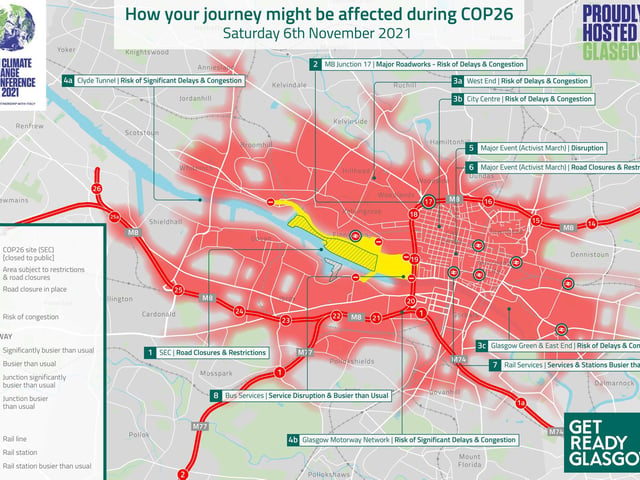
4. COP26 traffic
Where the congestion could be on November 6. Photo: getreadyglasgow.com