

Before the eighteenth century, Calton was a semi-rural weaving village outside Glasgow’s municipal boundary. The name comes from the Scottish Gaelic phrase A’Challtainn, meaning the hazel wood. It’s most famous landmarks remain The Barras street market and the Barrowland Ballroom, with modern additions like music venue Saint Luke’s.
The area’s transformation began in the later 1700s with the expansion of handloom weaving. Calton’s proximity to the Clyde and to Glasgow’s growing mercantile centre made it attractive for textile workers seeking cheaper land beyond the city’s regulated guild structure. Rows of simple cottages and workshop-dwellings emerged, forming one of Scotland’s earliest industrial suburbs.
In 1818 Calton was formally incorporated into the City of Glasgow, by which time textile production and related trades had reshaped the area. The nineteenth century saw rapid urbanisation: tenement blocks replaced earlier cottages, accommodating waves of migrants from rural Scotland and, later, Ireland. Calton became emblematic of Glasgow’s East End—densely built, industrially employed, with a distinctive identity. Housing conditions, however, deteriorated under pressure of population growth.
Churches, friendly societies, and labour organizations anchored community life. Irish Catholic migration in particular shaped the district’s religious and cultural landscape, visible in institutions like St Mary’s Church where a meeting took place that led to the formation of Celtic Football Club.
Traditional industries declined after the First World War. Interwar housing surveys identified Calton as among the city’s most congested areas. Post-1945 urban policy therefore targeted it for comprehensive redevelopment. Slum clearance programmes in the 1950s–70s demolished large sections of nineteenth-century tenement stock, relocating many residents to peripheral housing estates such as Easterhouse. While new social housing blocks and road schemes altered the physical landscape, they also fractured longstanding neighbourhood networks.
Vacant land, declining population, and social deprivation became defining features. Yet the area’s proximity to Glasgow’s city centre and to major event infrastructure, particularly around Glasgow Green, positioned it for regeneration initiatives from the 1990s onward. Cultural projects and new residential development sought to reconnect Calton with the expanding central city. Remnants of historic street patterns and surviving tenements now coexist with modern infill and community facilities.
Today Calton retains a layered identity. It is simultaneously an East End neighbourhood with deep working-class roots and a changing neighbourhood welcoming new visitors and residents. In the last ten years, there has been a growth in independent businesses, particularly food and drink, centred around The Barras and the Gallowgate.
Here are some pictures that provide snapshots of the Calton’s past.
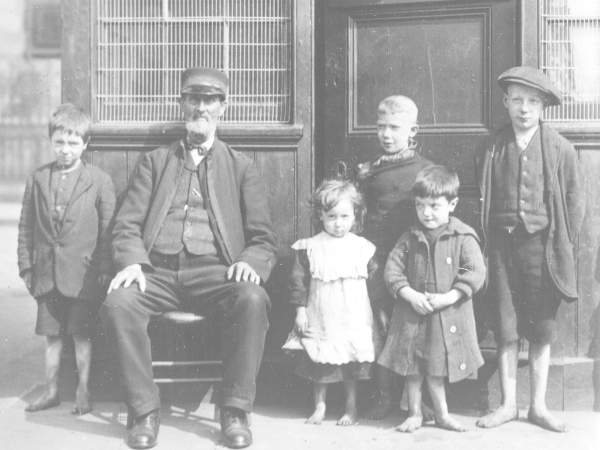
1. Bain Square (1900)
Playground attendant, 'Old Bob', with children on Bain Square | Virtual Mitchell
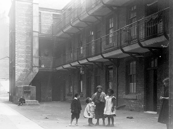
2. Calton (1902)
The rear of King Street Model Dwelling Houses (Millroad St), Calton. | Glasgow City Archives
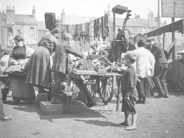
3. The Barras (1900)
A very early picture of the Barras when it was little more than a street market at the turn of the 20th century. | Virtual Mitchell
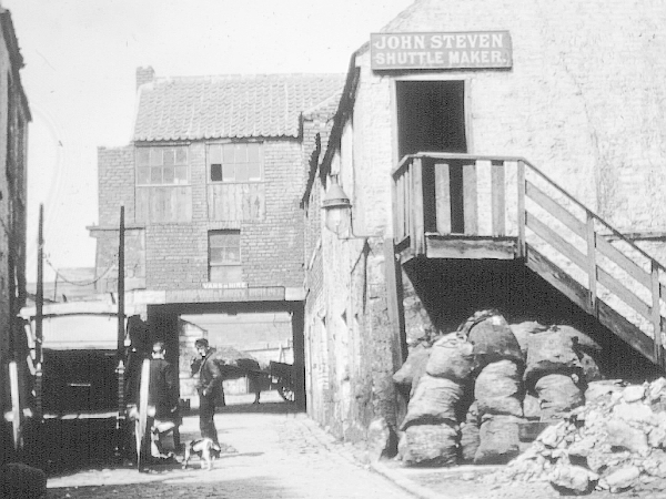
4. Calton (1916)
An unidentified back court in Calton in 1916 | Virtual Mitchell