Cold start to the week and snow forecast as temperature drops


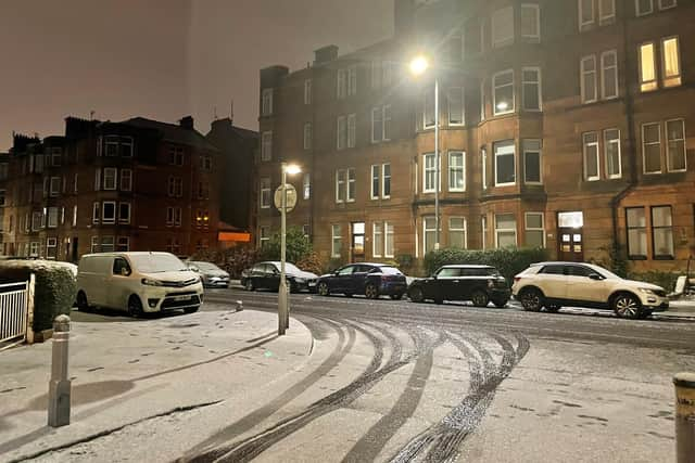
Warnings have been issued for snow and ice by the Met Office, as a northerly airflow will bring some disruptive weather through next week. Yellow warnings for snow and ice have been issued in northern and eastern areas of the UK. The Met Office say 5-10cm of snow could accumulate over northern Scotland and snow is likely within the warning area even on lower ground, with icy conditions likely to cause travel disruption.
The weather bulletin says: “The area of high pressure that has brought recent benign conditions will move away to the west at the start of next week, allowing a northerly airflow to sweep across the UK. The introduction of an arctic maritime airmass will bring snow showers to Scotland, Northern Ireland and along the east coast of England from Monday.
Advertisement
Hide AdAdvertisement
Hide Ad“The snow showers will predominantly impact northern and eastern areas; however, it will be cold across the UK, with widespread freezing conditions overnight.”
Deputy Chief Meteorologist, Chris Almond, said: “Very cold air will spread across the UK from late on Sunday through early next week. This brings with it snow even to low levels in the north and east through Monday and Tuesday, and in excess of 10cm could accumulate, most likely on high ground in the north, but also settling for a time at lower levels.
“With freezing overnight temperatures and the risk of ice, there’s a risk of some travel disruption and wintry hazards are likely to persist through much of next week, even further south for a time, so keep an eye on the Met Office forecast for the latest information.”
James Coles of Scottish Mountain Rescue and Team Leader at Moffat Mountain Rescue said: “The UK is entering a period of increasingly challenging weather conditions with snow, ice and gusty winds all featuring prominently in the forecast for the coming week. Upland areas, especially in the mountains, can see conditions change very rapidly and they may be markedly different from surrounding lowland areas.
Advertisement
Hide AdAdvertisement
Hide Ad“Met Office warnings come into force on Monday, but conditions ahead may deteriorate more quickly at higher elevations.”


Transport disruption
Stein Connelly, head of transport resilience (operations) at Transport Scotland, said: “We would urge the public to plan ahead, listen to Police Scotland travel advice, drive to the conditions, and also check before they travel. While our operating companies will be undertaking patrols and treatments and we are closely monitoring the network for impacts, it’s important to recognise that challenging conditions are likely early next week.
“Motorists can check with Traffic Scotland to make sure that their route is available. The new Traffic Scotland website gives people access to the latest travel information.
“We know that stopping distances can be up to ten times greater in snow compared to dry roads so keep well back from the road user in front, check your windscreen washer levels, ensure your mobile phone is charged and have sufficient fuel and warm clothing in case your journey is delayed.”
Advertisement
Hide AdAdvertisement
Hide AdTemperatures are likely to stay well below average for much of next week, with an increasing chance of snow around Glasgow from Wednesday onwards.
Senior Met Office meteorologist, Craig Snell, said: “We do see a bit of a change with even colder air coming through and then an increase in risk of sudden disruption due to some sleet, snow and some ice.
“So at the moment, the main focus is across northern and eastern parts of the UK where we have issued warnings already for Monday and Tuesday for the risk of some snow showers moving in from the north.
Glasgow Weather Forecast:
Tonight will see a cloudy start. Some spells of rain and hill sleet and snow will move in from the north. A second band of rain and hill snow will then move in later on.
Monday
Advertisement
Hide AdAdvertisement
Hide AdTomorrow will be cloudy at first with a band of rain and hill sleet and snow clearing to the south. It will then turn drier but colder through the day with sunny spells and isolated snow showers.
Outlook for Tuesday to Thursday
Tuesday is expected to be a mainly dry and bright day with long spells of winter sunshine. A cold and frosty night. Wednesday will be another cold and icy day with plenty of sunshine and some bands of high cloud. Thursday will continue to be cold. It is likely to cloud over from the south during the morning, with a chance of light snow from the afternoon onwards.
Comment Guidelines
National World encourages reader discussion on our stories. User feedback, insights and back-and-forth exchanges add a rich layer of context to reporting. Please review our Community Guidelines before commenting.