
Over 50 roads in Glasgow to close amidst Orange Walks participating in Boyne Parade

Glaswegians can expect disruption this weekend (Saturday, July 5) as over 50 roads will close for the Boyne Parade
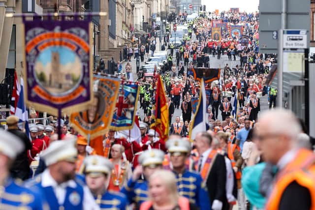
Over 3,500 lodge and band members will join over 50 Orange parades throughout Glasgow before converging on Glasgow Green this Saturday, July 5.
The Boyne Parade is the largest yearly celebration put on by the County Grand Lodge of Glasgow’s Boyne - with well over 3,500 members taking part with more onlookers and participants looking on from the side-lines across Glasgow.
Glaswegians can expect major disruption all over the city as a total of 56 roads will be closed throughout the day to allow passage of the Orange parades.
A restriction of no waiting or loading or unloading will be put in place from 4pm July 2 until 4pm July 5 on Monteith Row between Greendyke Street and Monteith Place. Further waiting, loading and unloading restrictions will be in place from 4pm on July 4 until 4pm on July 5.
Bus lane regulations will be suspended for several roads in the city centre as well from 5am until 4pm on July 5.
The earliest set off time begins at 8.25am from local Orange Halls across different districts of the city like Dalmarnock, Drumchapel, Ibrox, Maryhill, and Springburn.
Groups will come together in North, East, South, and West contingents making their way to Glasgow City Centre before marching together down to Glasgow Green.
1500 people make up the South Group, who will begin at Centre Street at 11.20am - marching along Commerce Street, King George V Bridge, Oswald Street, and then Hope Street.
More than 900 people make up the East Group - who meet at Brook Street at 10.10 am - they will march down London Road, Bain Street, Gallowgate, Moir Street, Glasgow Cross, High Street, George Street, Montrose Street, and Cochrane Street before merging with the main parade and making their way to Glasgow Green.
Around 530 members form the West Group - who meet at Kelvin Way at 10:30 - making their way down Sauchiehall Street, Blythswood Street, Blythswood Square, and West George Street before merging with the main parade at Hope Street.
750 people make up the North group - meeting at Corn Street at 10:30am, they will march down Garscube Road St. George’s Road, Charing Cross, Sauchiehall Street, Blythswood Street, Blythswood Square, down West George Street and merge with main parade in Hope Street.
It is hoped that all parades will join together at Hope Street at 11am - from there they will follow this route: West George Street, Nelson Mandela Place, West George Street, George Square North, George Street, High Street, Saltmarket and into Glasgow Green via the McLennan Arch.

Affected roads with restricted vehicle movements from 5am until 4pm on July 5 include:
- Albion Street between George Street and Blackfriars Street
- Anchor Lane for its full length
- Bell Street between Albion Street and Watson Street
- Bridgegate between King Street and Saltmarket
- Cochrane Street for its full length
- College Street at its junction with High Street
- Duke Street between John Knox Street and George Street
- Dundas Street for its full length
- Gallowgate between Trongate and Watson Street
- George Square (all sides) for its full length
- George Street for its full length
- Greendyke Street for its full length
- High Street for its full length
- Ingram Street between Albion Street and High Street
- Ingram Street between Queen Street and Glassford Street
- King Street (southbound only), between Bridgegate and Osbourne Street
- London Road between James Morrison Street and Saltmarket
- Montrose Street between Richmond Street and Ingram Street (access to car park remains open)
- Nelson Mandela Place, for its full length
- Nelson Street between Bridge Street and Commerce Street
- North Hanover Street between Cathedral Street and George Square
- North Portland Street between Richmond Street and George Street
- Parsonage Row at its junction with High Street
- Saltmarket for its full length
- Shuttle Street for its full length
- St Andrews Street for its full length
- Trongate between Albion Street and High Street
- West George Street between West Nile Street and George Square