First snow of winter on its way to Glasgow within next 48 hours say experts

and live on Freeview channel 276
Weather experts have identified period of time within the next 48 hours that could see some snow fall for several hours in Glasgow.
Weather graphics published by experts, WXCharts, clearly show snow over Glasgow on Friday November 26 (see chart below).
Advertisement
Hide AdAdvertisement
Hide Ad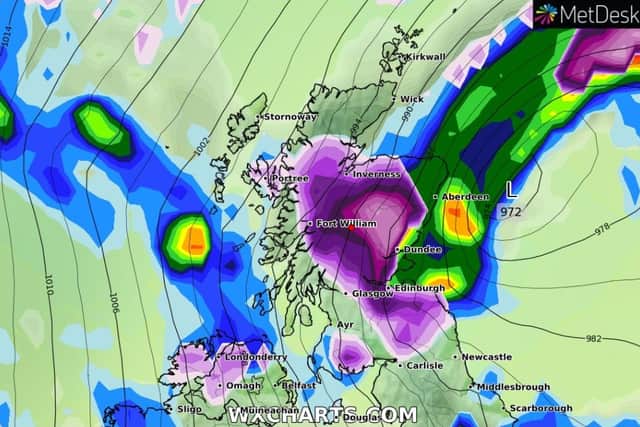

The snow is predicted to fall shortly after midday and could last right up to 6.00pm.
The threat of snow comes on the same day a yellow status weather warning for wind will be in place for wind.
The warning was issued on Tuesday morning and will be active between 12.00pm on Friday and 11:59pm on Saturday.
What to expect
- Some delays to road, rail, air and ferry transport are likely.
- There is a slight chance of some damage to buildings, such as tiles blown from roofs.
- There is a small chance that some roads and bridges could close.
- There is a slight chance that power cuts may occur, with the potential to affect other services, such as mobile phone coverage.
Comment Guidelines
National World encourages reader discussion on our stories. User feedback, insights and back-and-forth exchanges add a rich layer of context to reporting. Please review our Community Guidelines before commenting.