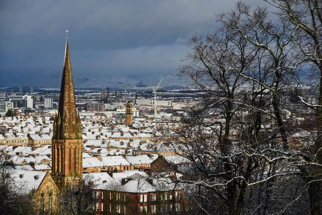
UK weather: Arctic blast means snow for Glasgow within next 24 hours as sub-zero temperatures begin to bite

and live on Freeview channel 276
The Met Office has issued a yellow status weather warning of ice for Glasgow.
The warning was issued on Thursday and is valid from midnight tonight to 11.00am on Friday.
Advertisement
Hide AdAdvertisement
Hide Ad“Northwesterly winds bringing cold, showery conditions, leading to icy patches overnight and into Friday morning,” reads the warning on the Met Office website.
“This is most likely on untreated surfaces, but in some places grit or salt may be washed off by heavy showers.
“Showers will be wintry at times even to low levels, with a few cm of snow possible on some of the the highest routes, and smaller amounts down to around 100-150 metres elevation,” the Met Office added.
What to expect:
- Some injuries from slips and falls on icy surfaces.
- Probably some icy patches on some untreated roads, pavements and cycle paths.

Advertisement
Hide AdAdvertisement
Hide AdMeanwhile, weather experts at online weather forecasting service, WXCharts, think the first of the snowfall could arrive at approximately 6.00am on Friday.
Heavier and more sustained snowfall is forecast for Sunday and is expected to last for several hours.
Strathclyde weather forecast
Thursday February 3 - Monday February 7
Headline:
Rain clearing most by mid-morning, but returning to Argyll later.
Today:
Cloudy start with occasional rain. Turning largely dry mid-morning, with some limited brighter spells developing. However cloud thickening from northwest late afternoon, bringing rain to Argyll towards early evening. Mild temperatures but not feeling so in the brisk westerly winds. Maximum temperature 11 °C.
Tonight:
Advertisement
Hide AdAdvertisement
Hide AdBand of rain over Argyll crossing rest of area during evening, clearing to a showery northwest flow by midnight, these turn increasingly wintry overnight, particularly in heavier outbreaks in Argyll. Minimum temperature -1 °C.
Friday:
Cold in brisk northwest winds. Wintry showers frequent and heavy at times over Argyll, with risk hail and thunderstorms, while Lanarkshire sees the best of the limited shelter. Maximum temperature 6 °C.
Saturday starts with cloud and rain, which clears to blustery and increasingly wintry showers. Wintry showers Sunday, frequent and heavy in north. Rain then showers Monday.
Comment Guidelines
National World encourages reader discussion on our stories. User feedback, insights and back-and-forth exchanges add a rich layer of context to reporting. Please review our Community Guidelines before commenting.