Orange walk: road closures revealed for annual Glasgow Boyne Parade

and live on Freeview channel 276
The main march will be on Saturday, July 2 - one day after the anniversary of the Battle of the Boyne, where, in 1690, William III’s forces beat those of the deposed James II - the last Catholic monarch in British history.
The result was a major dent in James’ bid to be restored to the throne and helped secure William III and Mary II’s - both Protestant - position.
Advertisement
Hide AdAdvertisement
Hide AdThe annual Boyne celebrations are the biggest in the Protestant calendar, with dozens of Orange groups marching through Glasgow.
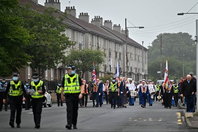

The biggest is being organised by the County Grand Orange Lodge of Glasgow, with an estimated 4075 people taking part in the march from 10.35am onwards.
Road closures
The following roads will be closed to traffic between 5am and 4pm on July 2.
- Albion Street, between George Street and Blackfriars Street
- Anchor Lane, for its full length
- Bell Street, between Albion Street and Spoutmouth.
- Bridgegate, between King Street and Saltmarket
- Cochrane Street, for its full length
- College Street, at its junction with High Street
- Duke Street, between John Knox Street and George Street
- Dundas Street, for its full length
- Gallowgate, between Trongate and Watson Street
- George Square (East), for its full length
- George Square (North), for its full length
- George Square (South) for its full length
- George Square (West), for its full length
- George Street, for its full length
- Greendyke Street, between London Road and Saltmarket
- High Street, between Cathedral Street and George Street
- High Street, between John Knox Street and George Street
- Ingram Street, between Albion Street and High Street
- Ingram Street, between High Street and Glassford Street
- King Street (southbound only), between Bridgegate and Osbourne Street
- London Road, between Trongate and Charlotte Street
- Montrose Street, for its full length
- Nelson Mandela Place, for its full length
- Nelson Street, both sides between Bridge Street and Commerce Street
- North Hanover Street, between Cathedral Street and George Square (North)
- North Hanover Street, between George Square North and Queen St Station entrance
- North Portland Street, between Richmond Street and George Street
- Parsonage Row, at its junction with High Street
- Saltmarket, between High Street and Clyde Street
- Shuttle Street, between College Street and Ingram Street
- St Andrews Street, between Saltmarket and James Morrison Street
- Trongate, between Albion Street and High Street
- West George Street, Nelson Mandela Place and George Square
Comment Guidelines
National World encourages reader discussion on our stories. User feedback, insights and back-and-forth exchanges add a rich layer of context to reporting. Please review our Community Guidelines before commenting.