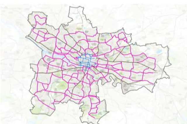
Plans for Glasgow active travel network, including 270km of cycle lanes and footpaths, unveiled


What does it include: Released as part of a new strategy to promote active travel in Glasgow, the plans will add 270km of high quality cycleways and improved footways along main roads in Glasgow.
Why have they created the plan: Intended to support a crucial shift to walking, wheeling and cycling as part of the wider effort to reduce the city’s carbon footprint and improve air quality, the new network will be designed to ensure easy access to safe, segregated routes from homes, schools, key amenities and cultural destinations throughout the city.
Advertisement
Hide AdAdvertisement
Hide AdBased upon a vision that active travel becomes the first choice for everyday journeys, the network is to be created with the aim that schools are within 400m of the main active travel routes while no home is more than 800m from segregated cycling infrastructure.
With key routes such as the South City Way in development and Garscube Road already in place in the city, and plans to develop further avenues throughout the city centre in line with the successful completion of the Sauchiehall Avenue, it is anticipated that the new active travel network will allow anyone who cycles to reach most of the city within 30 minutes and almost all of the city within an hour.
What does the council say: Councillor Anna Richardson, city convener for sustainability and carbon reduction, believes the vision for the city network builds upon significant progress already being made in Glasgow on active travel. She sees a city network of active travel infrastructure as the key to encouraging a widespread shift to walking, wheeling and cycling as the preferred mode of transport for increasing numbers of people.
Councillor Richardson said: “Safety is the number one reason for people being discouraged from using active travel and in particular, cycling. The existing network is expanding and the Spaces for People project helped show the appetite for change. By creating a network of cycle lanes and associated footways that reaches into every corner of the city we will maximise the opportunity for active travel to be the first choice for everyday journeys.
Advertisement
Hide AdAdvertisement
Hide Ad“Glasgow’s population is continuing to rise with the obvious consequence that more and more journeys are being taken in the city. To avoid increasing traffic levels, congestion, air pollution and road safety issues in future then we must provide alternatives for people to get about the city.
“By having an active travel network easily accessible to every home and school across the city we can start to turn around a situation with half of the vehicle journeys in Glasgow are less than 3km. By reducing our reliance on private vehicles for getting about Glasgow we can begin to reduce the carbon impact of our transport system. Encouraging a shift to the most sustainable form of transporting available to us can make a major contribution to Glasgow’s effort to tackle climate change.”
How much will it cost: It estimated the network would cost an estimated £470m, and work to engage with the Scottish Government has begun on access financial support from the national active travel budget.
Consultation: The strategy will be subject of a public consultation starting in mid-October.
Comment Guidelines
National World encourages reader discussion on our stories. User feedback, insights and back-and-forth exchanges add a rich layer of context to reporting. Please review our Community Guidelines before commenting.