Glasgow weather: Met Office forecast this weekend in wake of Hurricane Ian - is it hitting UK shores

and live on Freeview channel 276
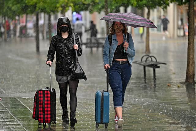
Hurricane Ian has caused havoc throughout Florida, and is expected to cause strong winds and rain across parts of the UK, including Glasgow.
The Met Office said the storm will push tropical air across the UK on Friday, causing heavy rain in several parts of the UK.
Advertisement
Hide AdAdvertisement
Hide AdHowever, these conditions are expected as we move into the cooler autumn/winter seasons.

Deputy Chief Meteorologist at the Met Office, Chris Almond, said; “This will bring a much wetter and windier spell than we’ve seen so far this autumn, but nothing that is unusual for the time of year.
“The fast-moving system will bring strong gale force winds, locally in excess of 60mph, and heavy rain into the northwest before pushing quickly southeast through the day.
“We could see some minor impacts, such as surface water flooding or minor wind damage, as well as some short-lived impacts on ferry crossings, especially in exposed areas of western Scotland and eastern areas of Northern Ireland.
Advertisement
Hide AdAdvertisement
Hide Ad“Later in the day, parts of southeast England could experience winds of around 55mph, which may impact the English Channel too.”
So, will Glasgow see some of the effects of Hurricane Ian? Here’s everything you need to know.
What is Hurricane Ian?
Hurricane Ian is said to be one of the most powerful storms the US has ever endured.
The Hurricane slammed into the coast of Florida on Wednesday afternoon with winds reaching up to 150mph.
Advertisement
Hide AdAdvertisement
Hide AdThe conditions have caused mass disruption and damage across the state with airports closing and a hospital roof being blown off.
The category four hurricane was downgraded to a tropical storm later on, forcing thousands to evacuate.
Ian is currently making its way north via Florida and the hurricane is expected to reach the Atlantic on Thursday morning.
On Friday, it is predicted to make landfall in Georgia and South Carolina. Virginia has declared a state of emergency, joining Georgia, North Carolina, South Carolina, and Florida.
Advertisement
Hide AdAdvertisement
Hide AdHurricane Ian made landfall on Cuba’s western coast on Tuesday, September 27. After the island was thrown into total darkness, power has now been restored in certain sections.
What is the Met Office forecast for Glasgow?
Thursday, September 29
Tonight is expected to be mostly dry with clear spells with clouds developing throughout the evening.
Outbreaks of rain will spread east through the early hours with the rain becoming heavier and more persistent in western areas.
Southerly winds will get stronger also. Temperatures will hit lows of 7°C.
Friday, September 30
Advertisement
Hide AdAdvertisement
Hide AdFriday will start off wet and windy with heavy and persistent rain as well as strong southerly winds.
Brighter and showery conditions will develop from early afternoon with winds also easing.
Temperatures will hit highs of 16°C.
Outlook for Saturday to Monday
Sunny spells will be evident throughout this period with the occasional heavy rain, with the potential for thunder on Saturday.
Sunny spells will continue on Sunday with a few showers throughout.
Monday morning will be dry but more rain is expected as the day develops.
Comment Guidelines
National World encourages reader discussion on our stories. User feedback, insights and back-and-forth exchanges add a rich layer of context to reporting. Please review our Community Guidelines before commenting.